 |
 Rhodes Rhodes
Useful Information
- Alternates spelling: Rhodos, Rodos
- Tel. code:2241
Getting there and Away
- By Air: There are 5 flights from Athens a day, 75 EU., flights also from Thessaloniki, Heraklion,Crete,
Kos, Karpathos, Santorini, Kastellorizo, and Kassos with varying degrees of frequency.
- Fewer in winter.
- By Sea: One to four ferries per day from Piraeus,23 EU, 15 hr.
- There are several flights a day to Rhodes with Olympic and Air Greece as well as many ferryboats
to its various ports. It is a 22 hr. voyage. You can see the many ferry schedules
by clicking the links above left.
- Rhodes is linked with varying degrees of frequency to: Mykonos, Santorini, Amorgos, Crete's 3 ports, Kos,
Limnos, Paros, Thessaloniki, Chios, Chalki, Lesvos, Kassos, Karpathos, Patmos, Nisyros, Samos and Astypalea.
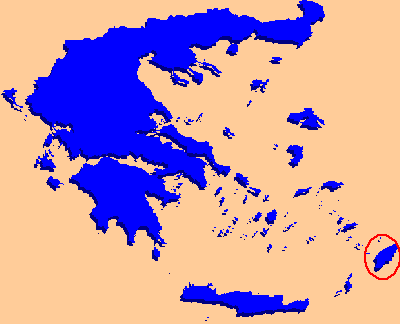
Rhodes Island
 Greece’s fourth largest island (after Crete, Evia and Lesvos/Mytilini) Rhodes (Rhodos in Greek) is the most visited Greek
island after Crete, with about one million tourists annually, both Greek and foreign (mostly from Europe, including Germans,
British, Swedes, Danes and Italians). Greece’s fourth largest island (after Crete, Evia and Lesvos/Mytilini) Rhodes (Rhodos in Greek) is the most visited Greek
island after Crete, with about one million tourists annually, both Greek and foreign (mostly from Europe, including Germans,
British, Swedes, Danes and Italians).
It is only 11km from the southwest Asia Minor coast, and separated from it by the Strait of Marmara. The largest of the Dodecanese island group, it accounts for more than half of its population with
110,000 inhabitants. It s length from north to south is 77km with a maximum width of 35.5km. West of the island’s center a
range of high hills runs the length of the diamond-shaped island, with Mt. Ataviros the highest peak, at 1215 meters.
Rhodes is for the most part a very fertile island, with a large variety of vegetation. There are oranges, lemons, olives,
figs, pears, pistachio. Trees include myrtle, heath, laurel, and the flowering bush known commonly as ‘rock-rose’ (cistus is
its scientific name) is very plentiful. In Greek, ‘rhodos’ is the older name for ‘rose’, and some attribute to the rock-rose
the naming of this island, though this plant is not native, and the name may have been taken, alternatively, from the Greek
word for pomegranate—rhodhi. There are also herbs such as marjoram, sage, lavender and styrax. Fauna include foxes, hares,
badgers, martens, hedgehogs, patridges, vultures, jays, jackdaws, deer (reintroduced by the Italians), snakes, lizards and
butterflies. The Phoenician word for snake is ‘erod’, presenting another possible explanation for the island’s name, as its
snake population in ancient times was sizeable. The smaller snakes, however, are the poisonous ones, the large snakes being
quite harmless. The lizard commonly known as the ‘Rhodes dragon’ is extremely large, reaching a length of 35.5cm.
Rhodes is famous for its warm climate and its number of days per year of sun (300), and is compared to the climate of
eastern Sicily. It is a windy island (with many windmills) though the east side is more sheltered. The rainy season is
from November to the end of March (similar to that of the Cyclades, though it often rains later in the latter group and also
gets colder). Even more than with other popular islands, Rhodes is best visited before June and after August, as it visited
by vast numbers of tourists during the summer months. Though tourism is concentrated in the upper third of the island,
the sandy, sheltered beaches of the east coast have made it inevitable that development would encroach there as well,
though between Faliraki and Lindos, you can still find uncrowded beaches
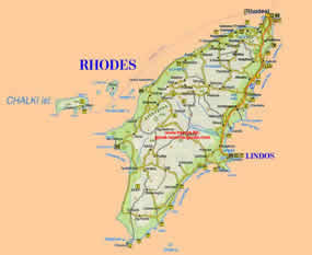
Rhodes Town

 The remarkably preserved medieval city of Rhodes has a population of 60,000, out of the 98,000 on the island in total. It is the
largest town in the Dodecanese as well as the largest capital. The new town surrounds the old walled one on three sides and
was founded in the form of new suburbs during Ottoman times by Greek Orthodox Christians forbidden to live in the old town
(and required to leave it by sundown or lose their heads). Since then, the suburbs (called 'marasia') have merged. The
walled town, as one would expect, has become very commercialized, as well as the modern district of 'Neohori' to the west of
Mandraki yacht harbor, which has a beach with all of the tourist paraphernalia one might also expect. The remarkably preserved medieval city of Rhodes has a population of 60,000, out of the 98,000 on the island in total. It is the
largest town in the Dodecanese as well as the largest capital. The new town surrounds the old walled one on three sides and
was founded in the form of new suburbs during Ottoman times by Greek Orthodox Christians forbidden to live in the old town
(and required to leave it by sundown or lose their heads). Since then, the suburbs (called 'marasia') have merged. The
walled town, as one would expect, has become very commercialized, as well as the modern district of 'Neohori' to the west of
Mandraki yacht harbor, which has a beach with all of the tourist paraphernalia one might also expect.
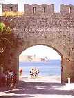  The approach from the sea is best, with its massive walls rising up from the water, the Palace of the Grand Master, the
minarets and the waterfront with its arcades. Windmills from the 14th century add to the picture. There are three harbors (the smallest of which is Mandraki, which caters to yachts, excursion boats and smaller ferries). and eleven gates into
the city, one of the most impressive being the Gate of Emery d'Amboise/Pili Ambouaz near the Palace of the Grand Masters,
built in 1512.. A lighthouse guards the entrance, along with the fort of Ahios Nikolaos, built 1460s against Ottoman Turkish
attacks. By now it may have been converted into a naval museum. Where the famous Colossus may have stood are now a bronze
stag and doe. A chain crossed here (blocking the entrance)during the time of the Knights, with ships paying a 2% tax (based
on the value of their cargoes) to help the war effort. The walls are magnificent, but accessible only via guided tours
(people usually meet for this in front of the Palace of the Grand Masters). You can most likely find a schedule easily). Four
Grand Masters constructed the walls on top of the older Byzantine walls. They extend 4km and are on the average 38feet thick
. In addition, they were curved to deflect missiles aimed at them, and surrounded by a dry moat 100 feet wide. The Knights
were assigned the defense of their respective bastions and towers according to nationality , with the exception of the
Italians, who were put in charge of the Knights' fleet.
  The Old Town (Palaia Poli) is a fascinating place to wander around, with its pebble pavements ('hokhlaki'), archways,
ochre and blue walls of sandstone and limestone, and its oleanders, bougainvillea and hibiscus. The Italians, if they hadn't
lost the war, would have widened all the streets for cars and built a road encircling it (a frontage road). Such things can
never happen now that it is designated a UNESCO World Heritage Site, which also provided for restoration of historical
structures (and general infrastructure) as well as the burying of phone and electrical power lines. If you enter via the
Gate d'Amboise, you 'll soon be in the Collachium, which was a place of retreat for the Knights in the event of the outer
wall being taken by an enemy. The Old Town (Palaia Poli) is a fascinating place to wander around, with its pebble pavements ('hokhlaki'), archways,
ochre and blue walls of sandstone and limestone, and its oleanders, bougainvillea and hibiscus. The Italians, if they hadn't
lost the war, would have widened all the streets for cars and built a road encircling it (a frontage road). Such things can
never happen now that it is designated a UNESCO World Heritage Site, which also provided for restoration of historical
structures (and general infrastructure) as well as the burying of phone and electrical power lines. If you enter via the
Gate d'Amboise, you 'll soon be in the Collachium, which was a place of retreat for the Knights in the event of the outer
wall being taken by an enemy.
Palace of the Grand Masters
 Palace of the Grand Masters (summer Mon 12:30-3pm, Tues-Fri 8:30am-9pm, winter Mon 12:30-3pm;Tues-Sun
8:30-3pm;6euros).was built over a temple of Helios (in Greek, 'Ilios'the Sun god); and some archaeologists believe that the
famed Colossus stood here, overlooking the harbor. The Palace, completed in 1346, was modelled after the Pope's palace in
Avignon, fourteen of the Grand Masters being French, and French being the official spoken language of the Knights' Order. Palace of the Grand Masters (summer Mon 12:30-3pm, Tues-Fri 8:30am-9pm, winter Mon 12:30-3pm;Tues-Sun
8:30-3pm;6euros).was built over a temple of Helios (in Greek, 'Ilios'the Sun god); and some archaeologists believe that the
famed Colossus stood here, overlooking the harbor. The Palace, completed in 1346, was modelled after the Pope's palace in
Avignon, fourteen of the Grand Masters being French, and French being the official spoken language of the Knights' Order.
The underground storerooms of the Palace were intended as a place of refuge for the entire local population during enemy
attacks or sieges. During Ottoman rule, the entire palace was used as a prison, even after the Gunpowder Explosion of 1856
when it was almost destroyed by an explosion of ammunition set off by lightning, and the first floor caved in. The
Italians did the same but then rebuilt it as a summer home for Mussolini (at his command) and for Victor Emmanuel III
(King of Italy and Albania, Emperor of Ethiopia). though neither of them, however, ever came to the island, the outbreak
of war preventing them from enjoying its 158 rooms. The Italians laid Roman mosaics from Kos on the floors, and Renaissance
furniture. They also put in a lift (elevator) and modern plumbing.
The inside is a bit of a Fascist fantasy of grand palaces with heavy furnishings and marble stairways and the like, though
the outside is closer to the real thing, based on medieval engravings and accounts. On the ground floor is the Medieval
Exhibit and Ancient Rhodes, 2400 Years , the first displaying fascinating trade items during the time that Christian Rhodes
was a major trade center. There is a display of the sugar-refining industry which was an enterprise of the Knights and a
Grand Master's gravestone, manuscripts and books, icons. The second floor deals with objects that reflect the daily life of the
ancients. Exhibits are presented with information in both Greek and English.
Street of the Knights
 Street of the Knights (Odos Ippoton) is east from the Platia Kleovoulou in front of the Palace. Before they were ousted
by the Ottoman Turks, the Knights of St. John stayed in inns lining this boulevard which were designated according the the
ethnic and linguistic origins of the Knights, each with the coat of arms of the Grand Master who was in charge at the time
that they were built. The Inn of France (1509) has crocodile gargoyles and escutcheons adorning it. The French Knights
predominated among the nationalities represented. Next to the inn is a townhouse that belonged to Villier de l'Isle Adam.
Close by are also the Inn of Spain, the Inn of Provence, the Inn of Italy, and, beyond two squares, the restored Inn of
England, which was first abandoned in 1534 when the Pope excommunicated Henry VIII. It was struck by an earthquake in 1851,
rebuilt by the British, bombed and rebuilt again in 1947. The old inn buildings are for the most part now occupied by
government offices and cultural institutions, but the Inn of Auvergne, built in the 15th century, houses a cultural center.
It is located past the arch, in the Plateia Argyrokastro, and is one of the most beautiful of the inns, with a fountain
from a Byzantine baptismal font. Near it is the first hospital on Rhodes, whicfh later became the Palace of the
Armeria, built by Grand Master Roger de Pins. Street of the Knights (Odos Ippoton) is east from the Platia Kleovoulou in front of the Palace. Before they were ousted
by the Ottoman Turks, the Knights of St. John stayed in inns lining this boulevard which were designated according the the
ethnic and linguistic origins of the Knights, each with the coat of arms of the Grand Master who was in charge at the time
that they were built. The Inn of France (1509) has crocodile gargoyles and escutcheons adorning it. The French Knights
predominated among the nationalities represented. Next to the inn is a townhouse that belonged to Villier de l'Isle Adam.
Close by are also the Inn of Spain, the Inn of Provence, the Inn of Italy, and, beyond two squares, the restored Inn of
England, which was first abandoned in 1534 when the Pope excommunicated Henry VIII. It was struck by an earthquake in 1851,
rebuilt by the British, bombed and rebuilt again in 1947. The old inn buildings are for the most part now occupied by
government offices and cultural institutions, but the Inn of Auvergne, built in the 15th century, houses a cultural center.
It is located past the arch, in the Plateia Argyrokastro, and is one of the most beautiful of the inns, with a fountain
from a Byzantine baptismal font. Near it is the first hospital on Rhodes, whicfh later became the Palace of the
Armeria, built by Grand Master Roger de Pins.
The Archaeological Museum
  The Knights' Hospital has been used to house the Archaeological Museum (Tues-Sun 8:30am-3pm; 2.40 euros). The main
exhibits are of decorated pottery from the sixth and seventh centuries BC, but they are poorly labelled and not well
presented. The Hellenistic statue gallery is nicer, with the 'Marine Venus' which Lawrence Durrell described in his book
with its name as title, the actual statue a bit strange with its disintegrated face. This is behind the sculpture garden on
the second floor. The sculpture of Aphrodite Bathing is more cheerful, by comparison. The Knights' Hospital has been used to house the Archaeological Museum (Tues-Sun 8:30am-3pm; 2.40 euros). The main
exhibits are of decorated pottery from the sixth and seventh centuries BC, but they are poorly labelled and not well
presented. The Hellenistic statue gallery is nicer, with the 'Marine Venus' which Lawrence Durrell described in his book
with its name as title, the actual statue a bit strange with its disintegrated face. This is behind the sculpture garden on
the second floor. The sculpture of Aphrodite Bathing is more cheerful, by comparison.
The Decorative Arts Collection (Tues-Sun 8:30am-3pm;1.50euros) is very interesting, with its collection of furniture from
Dodecanese houses, including carved doors and chest lids painted with depictions of mythological or historic themes,
embroideries, and costumes. There is also a reconstruction of a traditional room.
In Plateia Symis (next square to the north) are the ruins of a 3rd century BC Temple of Aphrodite, which was discovered by
the Italians in 1922. A Temple of Dionysos survives in fragments behind the Ionian and Popular Bank.
The Byzantine Museum (Tues-Sun 8:30am-3pm;1.50 euros) is housed in the old cathedral of the Knights, earlier a Byzantine
shrine of Panayia Kastrou, houses medieval icons and frescoes taken from ruined chapels on Rhodes and Halki and photos of
art from them. There is also a complete fresco cycle from the domes of Tharri monastery dating from 1624.
The Ottomans conquered Rhodes in 1522, and converted many Byzantine shrines to mosques (first evicting the Christians from
the Old Town). There is a sizeable Turking-speaking minority in Rhodes, some of them descended from Muslims who fled Crete
between 1898 and 1913 (during that last period of the Greek War of Independence). The Suleymaniye mosque built around
1522 on the site of a Church of the Apostles, and rebuilt during the 19th century , has the usual courtyard and fountain.
It also has a double portico, a Venetian Renaissance style portal, and a beautiful minaret with a double balcony. Up till
recently this mosque was off bounds and surrounded by scaffolding. There are many mosques in the Old Town, as well as
'mescids' (Islamic chapels). Behind the Suleymaniye mosque is the Byzantine clock tower, the Roloi ,from which you can get
wonderful views of the city.
 The Turkish Quarter is south of Sokratous Street, with wooden balconies up over the street and stone arches, open shops
and cafes. The atmosphere is still very Turkish. The Mustafa Mosque and the Mustafa Hamam/Turkish Bath are both on Platia
Arionos in southwest part of Old Town. (Opens various hours; get a schedule;.90 euros). The bathhouse was built in 1558 and
remodeled in 1765, when rooms were added for resting. Still heated by a ton of olive wood a day, it is an atmospheric place,
with mosaic floors, marble fountains, and an ornate ceiling, and is divided into men's and women's sections The Turkish Quarter is south of Sokratous Street, with wooden balconies up over the street and stone arches, open shops
and cafes. The atmosphere is still very Turkish. The Mustafa Mosque and the Mustafa Hamam/Turkish Bath are both on Platia
Arionos in southwest part of Old Town. (Opens various hours; get a schedule;.90 euros). The bathhouse was built in 1558 and
remodeled in 1765, when rooms were added for resting. Still heated by a ton of olive wood a day, it is an atmospheric place,
with mosaic floors, marble fountains, and an ornate ceiling, and is divided into men's and women's sections
Mosque Ibrahim Pasha
Off of Sofokleous Street is the Ibrahim Pasha mosque (1531) in front of which executions were held. The Redjep Pasha
Mosque (1588) which was once completely covered with Persian tiles, is near Omirou Street.
The Ottoman Library (Mon-Fri;7:30am-2:30pm and 6-9pm;Sat and Sun 8am-noon; no admission but suggested donation to
custodian). Built in 1793, the library contains rare Persian and Arabian medieval manuscripts and illuminated copies of the
Koran.
Odos Sokratous down from the Suleymaniye mosque, now a big tourist street, was once the center of the Ottoman bazaar.
Square of the Jewish Martyrs
The Platia ton Evreon Martyron/Square of the Jewish Martyrs was named to honor the large Jewish community of Rhodes
almost completely wiped out by the Nazis during the summer of 1944. The one remaining synagogue of the four in Rhodes is to
the south on Odos Simiou, and is called Kal Kadosh Shalom (open daily 10am-5pm;donation). This synagogue is maintained
basically as a memorial to the 1800 Jews from Rhodes and Kos deported to the concentration camps from here, with plaques in
French (the language of educated Ottoman period Jews in the Aegean). There's a museum in the back with photos of the Jewish
community and its life on Rhodes and also in its widespread diaspora in both the United States and in Africa. The museum was
set up by a Los Angeles attorney of Jewish Rhodian descent.
Our Lady of the Bourg was once the largest Catholic church on
Rhodes, built by the Knights to commemorate their defeat of the Turks in 1480. It was hit by a British bomb during the
war. Only ruins of this church remain.
The New Town
 Too-expensive cafes sit at the waterfront by Mandraki harbor. The New Market is behind them, which was
built by the Italians in the shape of an octagon. Instead of the vegetables of not long ago, souvkaki and gyros-Greece's
favorite fast foods--are sold. The theatre, post office and dimarheio (town hall) beyond them, were built by the Italians
during the 1920s in bleak Mussolini style. They also built the garish Governor's Palace, and the Cathedral Evangelismos (which copies St. John's, the cathedral blown up in the gunpowder incident). There is also a fountain copied from Viterbo's
Gothic Fontana Grande. There's a cemetery north of the theater, next to the Mosque of Murad Reis, named for the admiral of
the Egyptian Sultan, who was killed during the siege of Rhodes in 1522. His tomb is shaped like a turban. Near here is
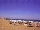
Elli Beach, horrifically crowded and packed with beach umbrellas and sunbeds, and by the sea a diving platform for high
divers. Too-expensive cafes sit at the waterfront by Mandraki harbor. The New Market is behind them, which was
built by the Italians in the shape of an octagon. Instead of the vegetables of not long ago, souvkaki and gyros-Greece's
favorite fast foods--are sold. The theatre, post office and dimarheio (town hall) beyond them, were built by the Italians
during the 1920s in bleak Mussolini style. They also built the garish Governor's Palace, and the Cathedral Evangelismos (which copies St. John's, the cathedral blown up in the gunpowder incident). There is also a fountain copied from Viterbo's
Gothic Fontana Grande. There's a cemetery north of the theater, next to the Mosque of Murad Reis, named for the admiral of
the Egyptian Sultan, who was killed during the siege of Rhodes in 1522. His tomb is shaped like a turban. Near here is
Elli Beach, horrifically crowded and packed with beach umbrellas and sunbeds, and by the sea a diving platform for high
divers.
The Aquarium, (open daily April to Sept 9am -9pm; Oct to March 9am to 4:30pm;1.75 euros) at the northernmost tip of
Rhodes (officially called the 'Hydrobiological Institute"), was built in 1938 by the Italians. It is the only one in all
of Greece, and has a pair of sea turtles over one hundred years old, and a collection of stuffed fish, as well as tanks of
live ones. Aquarium Beach is windy, and popular with wind-surfers and paragliders. The same is true of
appropriately-named Windy Beach, but better for swimming is Psaropoula (and also sandy). There are some coves south of there
with good swimming if there isn't much wind, but women should be forewarned that the area is nicknamed 'Flasher's
Paradise'.
To the southeast of the Aquarium is Villa Cleobolus, the home of English writer Lawrence Durrell during the second half of
the 1940s.
Ancient Rhodes Town
South of the New Town in a wooded area is Hellenistic Rhodes (southwest of Mandraki) on the hill of Aghios Stefanos.
The ancient acropolis is rather comically named Monte Smith after Admiral Sydney Smith who was posted here in 1802 to keep an
eye on Napoleon's Egyptian forays. It was identified in 1916 and partially excavated during the 1920s.
Tourists come here for the nice sunsets. A 2nd century BC Doric Temple of Pythian Apollo was reconstructed on top of
Monte Smith by the Italians, as well as the 3rd century BC Stadium, where classical plays are sometimes staged in the summer.
There are also some columns from temples of Zeus and Athena. The Ancient Theater is the only square theater found on the
islands.
Rodhini Park south of town 2km on road to Lindos. City Bus #3 goes there. On the ravine here (Zimbouli) are ducks, a
natural spring, peacocks (in pens) and native deer from Rhodes, said to have been imported by the ancient Rhodians on the
counsel of the Delphic oracle as a solution to their snake problem. There are many trees here, including cypress,
pine, oleander, and maple. The park is on the site of the Ancient School of Rhetoric of Aeschines (330BC), at which
Julius Caesar and Cicero learned to speak eloquently.
The rock-cut Hellenistic 'Tomb of Ptolemy'. (4th century BC) is nearby, on a sign-posted side road, and there are
also ruins of an aqueduct. The Knights grew medicinal herbs here. In late July-early August the Rhodes Wine Festival is
held here.
The East Coast of Rhodes
 The holiday resort of Reni Koskinou has Blue Flag beaches (given EU approval as a clean beach with unpolluted
waters). The village of Koskinou is known for its hoklaki (pebble mosaic) courtyards and traditional architecture. There
are good tavernas in this town. On the way there you might pass through Asgourou, a Turkish village with a mosque converted
from an Orthodox church. This town has become an industrial one, so you might want to push on towards the coast. Kalithea has coves popular with swimmers and snorkellers, and the old thermal spa, Thermes Kallitheas, is being restored by the EU.
The building was built during the 1920s by the Italians, in rather garish Moorish style. It sits amid pine trees 3km south of
Reni Koskinou. Hippocrates praised the healing powers of the spring waters here, though sadly, they have stopped flowing
(though the cause seems to be unknown). There are some bays south of here with scuba diving outfits. The holiday resort of Reni Koskinou has Blue Flag beaches (given EU approval as a clean beach with unpolluted
waters). The village of Koskinou is known for its hoklaki (pebble mosaic) courtyards and traditional architecture. There
are good tavernas in this town. On the way there you might pass through Asgourou, a Turkish village with a mosque converted
from an Orthodox church. This town has become an industrial one, so you might want to push on towards the coast. Kalithea has coves popular with swimmers and snorkellers, and the old thermal spa, Thermes Kallitheas, is being restored by the EU.
The building was built during the 1920s by the Italians, in rather garish Moorish style. It sits amid pine trees 3km south of
Reni Koskinou. Hippocrates praised the healing powers of the spring waters here, though sadly, they have stopped flowing
(though the cause seems to be unknown). There are some bays south of here with scuba diving outfits.
 Faliraki (right) is an enormous resort with a less than appealing reputation for attracting the worst of erotic sun-sand-sex
types (age 18-30s) and even dangerous encounters in the same area of human activity. Shopping malls, big hotels, all sorts
of fun and games and watersports are to be found here. To the south of all this is the peninsula of Cape Ladhiko with pebble
beaches that get crowded quickly, and a campsite with a restaurant and bar. Faliraki (right) is an enormous resort with a less than appealing reputation for attracting the worst of erotic sun-sand-sex
types (age 18-30s) and even dangerous encounters in the same area of human activity. Shopping malls, big hotels, all sorts
of fun and games and watersports are to be found here. To the south of all this is the peninsula of Cape Ladhiko with pebble
beaches that get crowded quickly, and a campsite with a restaurant and bar.
To the south of the cape Afandou Bay boasts the biggest undeveloped beach on the east coast (at least it was that way
till fairly recently, and may still be relatively undeveloped if you're lucky though the area is not free of tourist
attractions. Afandou was once known for its carpets and its apricots, but has now gone down the money-paved tourist road,
but the beach is 7km long and the sea is deep and very clear so that balances out the tourist train and Chinese
takeaway.
At the bay's north end is Traganou beach with some caves. There's an eighteen hole golf course as well as tennis
courts inland from the bay, the first being the only one in Greece outside of Corfu (Kerkyra) island.Kolymbia is a resort
with plenty of big hotels, though there are good beaches south of the headland at Vagia Point, with a long line of
eucalyptus trees leading to them (one of the nicer features of this place). From the beach there are nice views to the north
to Cape Ladhiko The houses were built by the Italians during the 1920s for colonists., and are all the same. Meant to
resemble farmhouses, they all have big outdoor ovens and big chimneys.
 Tsambika (left) to the south, has a long sandy bay, and a little monastery up on the bluffs above, whose 11th century icon of the
Virgin Mary is visited on 8 September by women petitioning the Virgin (rather ironically) for fertility. The monastery is
built on a massive rock that was part of a larger mountain. If driving to it from the highway, the 1500-meter paved road
ascends very steeply to the base of the rock, and from there one must climb 297 steps to the monastery, which is at
300meters. The views from up there of the coastline are spectacular. The bay is on the south side of the headland and
though there is a paved road down to it, and a taverna, the area seems to have been protected from further tourist
development, but there are plenty of people nevertheless. The south end of the beach is wilder, though full of hermit
crabs. Tsambika (left) to the south, has a long sandy bay, and a little monastery up on the bluffs above, whose 11th century icon of the
Virgin Mary is visited on 8 September by women petitioning the Virgin (rather ironically) for fertility. The monastery is
built on a massive rock that was part of a larger mountain. If driving to it from the highway, the 1500-meter paved road
ascends very steeply to the base of the rock, and from there one must climb 297 steps to the monastery, which is at
300meters. The views from up there of the coastline are spectacular. The bay is on the south side of the headland and
though there is a paved road down to it, and a taverna, the area seems to have been protected from further tourist
development, but there are plenty of people nevertheless. The south end of the beach is wilder, though full of hermit
crabs.
Inland 5km are the Epta Piges (seven springs) which feed a pond/reservoir which in turn irrigates local farms. Here
you'll find pine trees, peacocks, geese, duck, greenery and a taverna next to the water. A 186 meter aqueduct tunnel built
by the Italians leads to the lake, but it must be waded through (with very cold water up to your ankles), but you have the
choice of reaching the pond from dry places as well (including from the village of Archangelos).
 Archangelos 29 km from Rhodes town, is the largest village on Rhodes (4000 approximately) with a crumbling castle of the
Knights and two churches: the Archangelos Gabriel and the Archangelos Michael, both of them very among the most beautiful on
the island. NearbyAghios Theodhorou has 14th century frescoes. Everything is painted blue and white in this village (a
definite sign of patriotism on the part of the villagers). The place is known for its ceramics and agriculture (mostly
citrus). There is a local dialect, a strong musical tradition, carpet-makers (of flat-woven carpets, though not terribly
impressive), and leather boot-craft, the boots meant to keep snakes from the wearers' feet in the fields. Visitors can have
them made to order, but they are pricey. Both boots in a pair fit either foot. This town has become the darling of German
package tourism, and the beach below it at Stegna, has also been swallowed up by same. Archangelos 29 km from Rhodes town, is the largest village on Rhodes (4000 approximately) with a crumbling castle of the
Knights and two churches: the Archangelos Gabriel and the Archangelos Michael, both of them very among the most beautiful on
the island. NearbyAghios Theodhorou has 14th century frescoes. Everything is painted blue and white in this village (a
definite sign of patriotism on the part of the villagers). The place is known for its ceramics and agriculture (mostly
citrus). There is a local dialect, a strong musical tradition, carpet-makers (of flat-woven carpets, though not terribly
impressive), and leather boot-craft, the boots meant to keep snakes from the wearers' feet in the fields. Visitors can have
them made to order, but they are pricey. Both boots in a pair fit either foot. This town has become the darling of German
package tourism, and the beach below it at Stegna, has also been swallowed up by same.
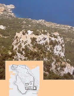
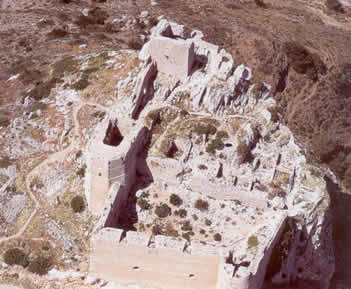
Haraki is the port of Malona (inland), with the remains of Feraklos castle (a Byzantine castle) overlooking it. Later a
Knights' castle, it was their last to fall to the Ottomans.
Aghia Agathi (St. Purity), was once a fairly secluded nearby beach (with encroachments in recent years) reachable only by a
dirt road outside of the village. Ask around.
 Lindos (left) is yet another enchanting place swallowed up by tourism, and is Rhodes second most visited place, with up to a half
million visitors annually. Although protected to an extent (no high-rises can be built there) the fine old 15th to 17th
century houses (some of them built by sea captains) have been bought up by both package companies and wealthy foreigners
since the 1960s (when it was an artist-expatriate colony). The town sits on a promontory high up over the sea, its white
houses resembling those of the Cyclades more than of Rhodes. The winding streets are cobbled and the mansions, built
around courtyards with the famous hoklaki (pebbled mosaics) have high walls and impressive doorways with intricate stonework. Inside they were built with high ceilings and raised sleeping platforms. The roofs, like those of Cycladic houses, are
flat (and used to look out at the views or for sunbathing these days), as many of them are now second homes or restaurants.
The town is known for its painted plates with Oriental motifs. There are 18th century frescoes in the Church of the Assumption, first built in the 10th century and later rebuilt by the
Grand Master of d'Aubusson in 1489-90. The frescoes were painted by Gregory of Symi in the late 18th century and restored in
1927. Lindos (left) is yet another enchanting place swallowed up by tourism, and is Rhodes second most visited place, with up to a half
million visitors annually. Although protected to an extent (no high-rises can be built there) the fine old 15th to 17th
century houses (some of them built by sea captains) have been bought up by both package companies and wealthy foreigners
since the 1960s (when it was an artist-expatriate colony). The town sits on a promontory high up over the sea, its white
houses resembling those of the Cyclades more than of Rhodes. The winding streets are cobbled and the mansions, built
around courtyards with the famous hoklaki (pebbled mosaics) have high walls and impressive doorways with intricate stonework. Inside they were built with high ceilings and raised sleeping platforms. The roofs, like those of Cycladic houses, are
flat (and used to look out at the views or for sunbathing these days), as many of them are now second homes or restaurants.
The town is known for its painted plates with Oriental motifs. There are 18th century frescoes in the Church of the Assumption, first built in the 10th century and later rebuilt by the
Grand Master of d'Aubusson in 1489-90. The frescoes were painted by Gregory of Symi in the late 18th century and restored in
1927.
First inhabited around 2000 BC, its first temple was built in 1510 on its steep acropolis (which means edge/peak of the
city). It was the most important of three ancient city-states of Rhodes, with the best harbors on the island (two of them)
and became rich from its colonies, especially Parthenope (now Naples). The ancient town of Lindos was four times the size
of the modern one and had a population of 16,000. Its 6th century BC tyrant Cleoboulos was one of the Seven Sages of Greece.,
a man of enlightened ideas, including the intellectual equality of women. St. Paul sailed to Lindos, bringing Christianity
with him; the Knights fortified it, and during Ottoman rule the merchants of the town handled most of the trade of the
island, sailing as far as present-day Spain. The tradition of boat-building continued into the 19th century.
The acropolis is open in summer Mon 12:30pm to 7pm;Tues-Sun 8am-7pm; and the rest of thye year Tues-Sun 8:30am-3pm;
6euros). The Knights of St. John ripped apart a lot of Hellenistic structures when they fortified this one. It was
excavated during the early 20th century by Danish archaeologists and later restored (badly) by the Italians. The Greek
restoration program is now in progress. The way up is very steep, and is walkable or by hired donkey. On the way you'll see
embroidered and other hand-crafted goods for sale. Lindos was known for its embroideries back in the time of Alexander the
Great. Watch out for factory -made goods along with the handcrafted ones, and be aware that almost everything is
overpriced.
 The prow of a trireme (5th century BC) is carved into the rock just before the Knights' stairway, the prow once serving as
a podium for a statue of a priest of Poseidon. There are vaulted rooms at the top and the ruins of the church of St. John
(13th century). The stoa of Lindian Athena is next, Athena the patron goddess of the city. The 'stairway of Heaven' leads
up from here to the foundations of the Propylaea and to the Doric Temple of Athena (much restored since the 1980s) on the
edge of the cliff . Seven columns remain. These were both built by Cleoboulos, rebuilt in 342 BC after a fire, and later
reconstructed by the Italians. There is a sanctuary in the rock openings where small bulls were sacrificed to the goddess.
The bay below is known as St Paul's Bay where he landed in AD58. The Grand Harbor is below this, with the town beach and
the Pallas Beach where the ancient Lindos navy moored its 500 ships. The prow of a trireme (5th century BC) is carved into the rock just before the Knights' stairway, the prow once serving as
a podium for a statue of a priest of Poseidon. There are vaulted rooms at the top and the ruins of the church of St. John
(13th century). The stoa of Lindian Athena is next, Athena the patron goddess of the city. The 'stairway of Heaven' leads
up from here to the foundations of the Propylaea and to the Doric Temple of Athena (much restored since the 1980s) on the
edge of the cliff . Seven columns remain. These were both built by Cleoboulos, rebuilt in 342 BC after a fire, and later
reconstructed by the Italians. There is a sanctuary in the rock openings where small bulls were sacrificed to the goddess.
The bay below is known as St Paul's Bay where he landed in AD58. The Grand Harbor is below this, with the town beach and
the Pallas Beach where the ancient Lindos navy moored its 500 ships.
Pefkos (pine trees) just south of Lindos, has a sandy beach with the trees that give it its name. Though lower-key than
Lindos it is still very much a package resort, with all the usual accouterments, though it has a large beach and some
coves.
West of Lindos
To the west of Lindos is Lardos, which is an appealing village in a valley with a nice square, though definitely on the
tourist track.It suffered terrible floods during the winter rainy seasons after the disastrous fires of the 1980s
upstream.
Keskinto, to the west, was the site of an observatory which is believed to have produced a mechanism likened to a
computer, discovered at the bottom of the sea near the tiny island of Antikythera. Moni Thari , founded in the 9th century,
and is thus the oldest surving religious building on the island of Rhodes, is located 2km from Laerma (in turn 12km inland
from Lindos) on the Profila road. There are 12th century frescoes here, in places four layers thick. Lardos Bay has sand
dunes, reeds, and marshes, though you must go to neighboring beaches to escape encroaching tourism. Especially recommended
are Glystra, in a sheltered cove, with umbrellas and a snack bar. Though Kiotari has hotels, its beach goes on for miles.
Until the 1990s it was virtually unknown to tourists, until the Orthodox church began selling off its holdings in the area.
It is frequented by mostly Germans and Italians.
The medieval village of Asklipio is on a hill, beneath the ruins of a crusader castle, while the church of the Monastery
of Metamorofosi dates from 1060, and has 15th century frescoes depicting Old Testament stories.
Yennadhi is a farming village with a dark sand and pebble beach, gear for water sports and sunbeds and three tavernas a
little way in from the beach. Aghios Yiorghios also has water-sports.
Lachania 10km south of Yennadhi and a little inland is a village taken over by artists, mostly German ex-patriates.,
many of whom restored houses abandoned after a post-war earthquake in exchange for free rent. There are some nice fountains
in the square, one of them with an Ottoman inscription. Rooms are available as well as some entire houses, rented out by the
Orthodox priest Papa Yiorgos, who also has a taverna, one of two good ones in the village.
Plimiri (at Cape Vigla) has a new marina and fish farm as well as nice unspoiled beaches. Nearby is the church of the
Zoodhochou Pighis with ancient Corinthian columns. The beach (which has no name) which stretches for 2km to the south of
Cape Vigla is one of the last turtle nesting sites in the Dodecanese. Hopefully, by now it has been granted official
protection, though up until very recently some simple signs were all that indicated the reasons for not disturbing the
area, especially at night. Aghios Pavlos (St. Paul) inland from Plimiri, was also built by the Italians as a 'model farm. It
is from here that you can take an unmarked dirt road to the beach where turtles nest, parking of course, off of the beach
itself.
Rhodes Southern Tip
Around the southern tip of the island Kattavia, surrounded by grain fields (wheat and barley) is the southernmost village
on Rhodes. In high season it draws windsurfers who drive out to Cape Prassonisi (which means 'leek island'), at the island's
southernmost tip. The town's inhabitants have mostly emigrated to find work in other parts of the world, though the town
boasts a gas station, and a few tavernas (not so cheap), including one with some vegetarian dishes. A paved road through a
military area and then a sandy isthmus take you out to the island, which has a lighthouse on it. On one side (the east) the
water is flat, and on the other there are six-foot waves. There are two wind-surfing outfits operating here, both with email
addresses: procenter.prasonisi@Eunet.at and Sportif@compuserve.com Though there are rooms, they fill up fast in July and
August, and there are no facilities for campers. Ruins of a 6th-7th BC century walled settlement was discovered by Danish
archaeologists at Vroulia, near the isthmus and up over the sea.
Mesanagros an inland hill village reachable by paved
road from Lahania (9km) has ruins of a 5th century basilika just outside of it. Remnants of floor mosaics survive and a
13th century chapel, as well as pebble mosaics (hoklakia) and stone barrel arches. Mesanagros is reachable as well as from
Katavia and both routes will get you to the 13th century monastery of Moni Skiadi which houses an icon of the Panayia
(Virgin Mary) and Child. It is said to have bled when stabbed by a heretic during the 15th century, with the stain still
visible (on the cheek). The hand that performed this act was said to have been immediately paralyzed. There is a festival
of the icon on 7-8September. It might be possible to spend the night there, but you'll need to ask someone in one of the two
villages about this first.
Up the West coast
The road (unpaved) continues down to the coast on the west. There are wonderful views from there but the sea is buffeted
by wind and the beaches get a lot of garbage washed up on them, both of these accounting for their being deserted. Apolakia,
a little to the north, has great watermelons, great wedding feasts, and a few rooms, though an unremarkable town. There
are some rooms here as well as some tavernas and kafeneia. South of this town 4km there's a taverna along the coast.
Continuing up the west coast the road going northeast from Apolakia towards Yennadhi offers an interesting short
side-trip on a road off to the north just in a little from the coast, which is paved (and sign-posted) and goes to the
irrigation reservoir. Dirt roads off of this road take you to to the small Byzantine chapel of Aghios Yiorgos Vardas,
which is well worth seeing with its 13th to 14th century frescoes. It's only about 4km from the main road, but you might
want to ask someone before heading out there how to find it.
 The most important village in the region to the north is Monolithos (monolith means 'single stone' in Greek), the stone
here being a 700 foot crag rising out of the sea, 2km west of the town, with a castle on top,(left) built by the Grand Master
d'Aubusson. Within it a stairway spirals to the top along with the 15th century chapel of Aghios Yiorghios, the latter
with some frescoes. Views are magnificent and include the islands of Alimnia and Halki , and can be enjoyed also from a
couple of tavernas up there. 5km of winding (though paved) road below the castle is is the bay of Fourni, with shaded
sand and gravel beaches , though swimmers must beware the strong currents. Around the headland are early Christian cave
dwellings. The town itself offers little except some rooms and the views of the bay below from the tavernas. The most important village in the region to the north is Monolithos (monolith means 'single stone' in Greek), the stone
here being a 700 foot crag rising out of the sea, 2km west of the town, with a castle on top,(left) built by the Grand Master
d'Aubusson. Within it a stairway spirals to the top along with the 15th century chapel of Aghios Yiorghios, the latter
with some frescoes. Views are magnificent and include the islands of Alimnia and Halki , and can be enjoyed also from a
couple of tavernas up there. 5km of winding (though paved) road below the castle is is the bay of Fourni, with shaded
sand and gravel beaches , though swimmers must beware the strong currents. Around the headland are early Christian cave
dwellings. The town itself offers little except some rooms and the views of the bay below from the tavernas.
Siana is the next town on the road after Monolithos, built below the summit of Mt Akramytis, (825 meters/2706 feet),
which is Rhodes second highest mountain. It is a very appealing village with stone houses ,some with clay roofs, built on a
hillside. There are wonderful coastal views from this town (and views of islets as well). It is known for its delicious wild
pine and sage honey and for its 'suma' (a local spirit similar to raki or tsipouro-both in turn similar to Italian grappa).
Both the honey and suma can be sampled in the local village kafeneia. Take a look inside the beautiful church of Aghios
Panteleimon with its restored 18th century frescoes while in this village.
Mt Akramytis has been proposed (along with Mt. Atavyros, Rhodes highest peak-see below) as a nature reserve since 1994 by
the local Association for the Protection of the Environment. The road approaching it from the north (from Kritinia) passes
through dense forest on its lower slopes.
Embonas is famous for its tobacco, wine, olives, dancing and festivals, with some of the best paneyiria (saints' day
festivals) on the island. Though some of the older folk still wear traditional costume, the reputation as a traditional
village has made the folklore a bit self-conscious, with busloads of tourists headed that way to see it 'presented'. The
wine cooperative CAIR is here, as well as Emery Winery, founded by a local family during the 1920s. The tasting room of the
latter is open Monday to Friday until 3pm. They have a good red wine with the name Cava (which usually means wine cellar or
liquor store) with 12.5% alcohol, made from a local grape call mandilari or amorgyiani, but it is their white 'Villare' which
has given them fame, the latter made from an indigenous grape called athiri, which grows at 700meters altitude on the slopes
of Mt Atavyros, the island's highest peak (1215meters/almost 3000 feet). This mountain can be climbed (if you are very
hardy) in three hours from Embonas, but is not an easy climb in any case. A temple of Zeus Atavros was built there but not
much remains. Aghios Isidoros is up here, with vineyards and tavernas, and is less touristic than Embonas.
 Kritinia is another village on a hillside. Its houses are white, and there are views of the sea from the square. It was
allegedly founded by Cretans. There's a folklore museum north of the village with no admission fee, with rural items,
including costumes. Kritinia is another village on a hillside. Its houses are white, and there are views of the sea from the square. It was
allegedly founded by Cretans. There's a folklore museum north of the village with no admission fee, with rural items,
including costumes.
North of Kritinia is Kamiros Skala, port of ancient Kameiros. Now it's a fishing village with tavernas and ferries leave
from here for Halki.
Above the port, surrounded by lemon and pine trees, is the Kastello (Kastro Kitrinias left), one of the most
impressive of the Knights' castles, though there isn't much in it (a chapel and cistern) great views are to be had from
here.
Southwest of here is Paralia Kopria (Manure Beach), which, despite its rather unsavory name, has an excellent
taverna.
Ancient Kameiros
Kameiros was one of the three Dorian cities that united late in the 5th century BC to become the city-state of Rhodes.
It was rediscovered in 1859 when some farmers found some graves and in 1859 excavations began by British and French
archaeologists.
The site is open Tues-Sun 8am-7pm in summer;8:30-3pm winter;3euros). The city is very well-preserved and
unearthed some of the richest archaeological finds in Greece.
A large reservoir supplied some 400 families in Hellenistic
times. The Italians began digging in 1914 and uncovered most of the ancient city, the Agora with its podium for public
speeches, the great Stoa of the Agora with its Doric portico and cistern, two temples, Roman houses, a Hellenistic house, a
late Classical fountain, baths, and an altar to the sun-god, Helios (in Greek, Ilios).
The site is on a gentle slope and
unfortified, probably settled by Minoans, who were not war-like and didn't built fortresses. The half-legendary prince
Althaemenes in particular is associated with this city, which was a town of agriculture and craft.
Theologos is a beach resort with quite a few hotels; Paradhisi the village just beyond the airport, often used as a base
while waiting for flights. Kremasti has a big festival 15-23 August (occasioned by the Panayia Kremastis, whose
miracle-working icon is there) with a street fair where hawkers sell their wares, an amusement park,and on the final day,
dancers in traditional costumes. Seeing good dancers in the Dodecanese dance the 'sousta', with its very fast and fancy
footwork, is well worth being there for. There's also a big church and schoolhouse funded by Rhodian expatriates in the
United States, and the biggest military barracks on the island.
 The monastery Our Lady of Filermos is a beautiful structure covered with bougainvillea, converted by the Knights from a
5th century basilika church and restored by the Italians. (right) The monastery Our Lady of Filermos is a beautiful structure covered with bougainvillea, converted by the Knights from a
5th century basilika church and restored by the Italians. (right)
A flight of steps lined with cypresses leads up to it. The coat of
arms of the Grand Master d'Aubusson adorn the monastery and its domed chapels.
Under this Frenchman, the monastery had both
Orthodox and Catholic altars. A path leading uphill from the monastery is lined with Stations of the Cross. In 1941 the
Italians shot down a huge cross erected on the summit in 1934 by the Italian governor for fear that the Allies would use it
as a target. Now there is a 52 foot cross there, financed by the Lions Club.
Ancient Ialyssos 5km inland from the fork at Trianda is open Tues to Sun 8am to 7pm;3euros. On a pine-covered hill, it
was founded by Byzantine hermits during the 10th century. Foundations of 3rd century temples to Zeus and Athena, built on
top of a Phoenician shrine are to the west.
The Ai Yeorghis Hostos is a subterranean chapel with frescoes built under the ruins of a small Byzantine church. Ixia
is a big cluster of hotels.
Inland Rhodes
Valley of the Butterflies
Inland Rhodes is mostly hilly and still has a lot of trees, despite disastrous fire not long ago. Petaloudhes (Butterfly
Valley) is 7km inland from the west coast road between Paradhisi and Theologos, and consists of a canyon divided into two
parts. You must buy a ticket at the booth at the entrance to either (the ticket good for the other side as well). It is
open May-Sept daily 8:30 to sunset; spring and autumn1.50euros; mid-Juneto mid-September 2.20euros.
Guide books seem to
differ as to whether the 'butterflies' are actually Jersey tiger moths (Panaxia quadripunctaria) or Quadrina moths
(Callimorpha quadripunctaria) that come to this valley and to a similar one on Paros island to spend the final phase of
their lives attracted to the oriental sweetgum trees here, also called 'storax' trees, which exude a vanilla scented resin
used in making frankincense. July to mid-September is the peak season for the moths, which cover the tree trunks, eat
nothing, merely conserving energy before mating, after which they die of starvation. The numbers of these rare moths have
declined in recent years due to the clapping of tourists who want to see them fly, which exposes their red backs, but which
also weakens them, so observe them quietly and respectfully should you visit.
The valley is beautiful in its own right, with or without plentiful moths. There is a taverna near the parking area and a
cafι next to a pond. There's also a nice trail through the valley with wooden bridges that cross back and forth over the
stream. Petaloudhes is the main publicized tourist attraction in Rhodes interior. The valley trail leads to the
monastery of Panaghis Kalopetra built in 1782 by Alexander Ypsilantis, grandfather of two brothers who wanted to be kings at
the beginning of the Greek War of Independence. The spot has picnic tables and nice views. Another trail leads to the
Monastery of Aghios Soulas off of the road that leads down to Soroni. There is a big festival here on 30 July with donkey
races and folk dancing-a festival described in the Lawrence Durrell book 'Reflections on a Marine Venus'.
Psinthos named for its spring, is a pleasant village with plane trees and several nice tavernas.
It is also the site of the defeat of the Turks by the Italians in 1912.
Profitis Ilias (Prophet Elijah) is the most thickly forested peak on Rhodes, and is the island's third highest (at 798
meters/2617feet). You can walk from Psinthos to Eleoussa (14 km), the latter in thick forest at the far east end of the
mountain's ridge. On the southeast slopes are the villages of Platania and Apollona. The latter has domed outside ovens
which are still used. Outside of Eleoussa is the Byzantine church of Aghios Nikolaos Foundoukli (St. Nicholas of the
Hazelnuts) with 13th to 15th century frescoes, with a spot next to it much favored for picnics by locals, with views out
over lovely agricultural land. The monastery of Profitis Ilias has an annual festival. Some Italian built hotels near it
are now used as a children's camp. There are some nice walks on the mountain. Salakos is a pleasant village from which to
hike uphill, with a nice platia, an Italian fountain and some kafeneia.
|
|
FEATURED PROPERTIES:Ikaria - Armenistis
New Maisonettes
Price: €209,000 - 125 m2
Bedrooms: 3 Baths: 2

|

